(4/63)
Saturday– 2/21/26
The drive between Carlsbad and Alamogordo brought us through a lot of nature. Leaving the caves brought us back into the desert, which slowly morphed into foothills and plateaus, which in turn exploded back into piney woods as we entered the Lincoln National Forest. Erica drove us through a beautiful sunset in the hills, only for us to be surprised to find snow still on the ground! We passed through the quaint ski village of Cloudcroft before beginning our descent down the Sacramento Mountains and into the Tularosa Basin proper.
We started the day early, since we knew we had some out of the park experiences we wanted to visit. The only real timeline we had today was a sunset adventure in the dunes, so we opted to hit the small entry trails early, and break during the afternoon. This brought us to the Playa Trail and the Dunes Life Trail.
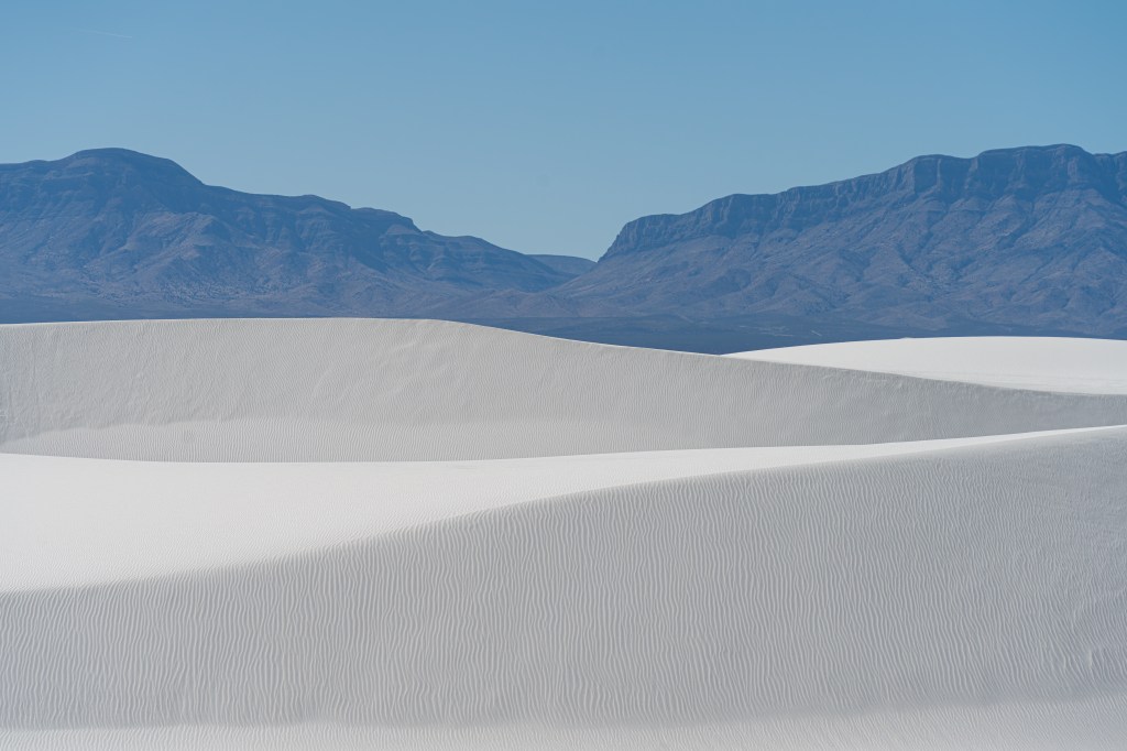
Due to the short length, Erica and I opted for the Playa Trail first. This trail taught us most of the geography of the dunes. Overlooking a playa, info boards brought us along the historical journey of the formation of gypsum and wildlife that inhabits it.
Over eons, when the region received rainfall, water would collect in a lowland now called Lake Lucero. The water would dissolve gypsum from the clay, and would evaporate leaving crystals called selenite. The selenite would then freeze, shatter into smaller pieces, and repeat until becoming fine grains of sand. The wind would carry this to the northeast, creating the dune-field that lies there today. This process continues to this day, slowly growing the dunes as it always has.
Field mice and jackrabbits inhabit the dunes, drinking from the shallow water table as it surfaces between the dunes, and hiding in the sotol and brush the grow near the moist alkali flats – or the moist sand between dunes that hugs the water table.
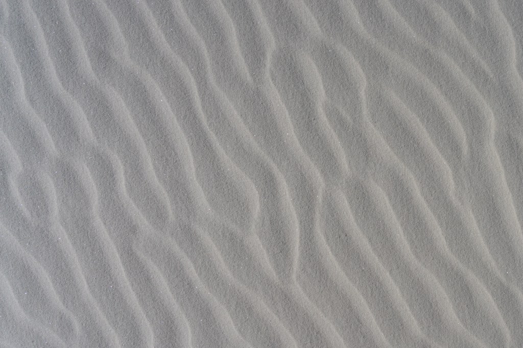
Armed with new knowledge, we set off for the Dunes Life Trail, eager to catch some footprints left by the exclusively nocturnal fauna. A quick steep climb on our first dune brought us to a vegetative dune field. We quickly learned a few things about the gypsum sand – its firmer than expected in most places, its cool to the touch, and it is bright. We hiked our one mile loop to the near end and realized the trail brought us to the steep end of a dune. Either we walk the long way around, or we take the fun way down. We opted for the fun way. A final lesson: sand is going to find its way into our boots a lot.
Nearing lunch, and knowing we have some detours, we left the park for Erica’s choice of diversion: McGinn’s PistachioLand, home of the world’s largest pistachio, of course. We sampled the many flavors of pistachios, and I nursed a single scoop of some admittedly very good pistachio ice cream. I was surprised to find that an orchard of pistachios was grown in the desert of all places. Another example of a plant reliant on the hot arid summers for fruiting and cold winters for dormancy.
On the way to lunch, we stopped by the New Mexico Museum of Space History to pay respects to mankind’s fastest great ape, Ham the Astrochimp. We launched Ham from Cape Canaveral, reaching speeds of 5,800mph and subjected to 17g of force. The first great ape launched into space, Ham proved mankind can live and work in outer space, and lived through the horrors of 1960’s views of animal testing. Thank you Ham.
Brown Bag Deli fed us our lunch, I opted once again for a Reuben and this one (remember Carlsbad?) was great. I mean I get it, its a sandwich, but I really enjoyed my food for the day.
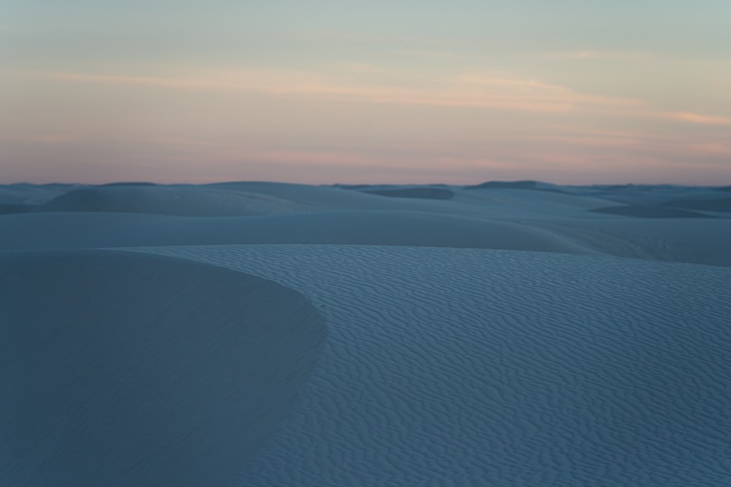
Back at the White Sands brought us to the Alkali Flats Trail. We intended to hike this full 5mi loop, take a small break, head back out for sunset photos and be on our way after.
Setting off on to the dunes was a quick reality check – not all dunes are created equal. Walking from the flat, moist and supportive flats would bring you to the base of a dune, where you’d decide to either climb the slick sandy face or take a long detour around to a less steep grade to climb the dune. Or, you’d be totally wrong and realize that hardened gypsum has become sandstone under a shallow coating of sand and the whole ordeal is a non-issue.
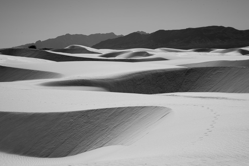
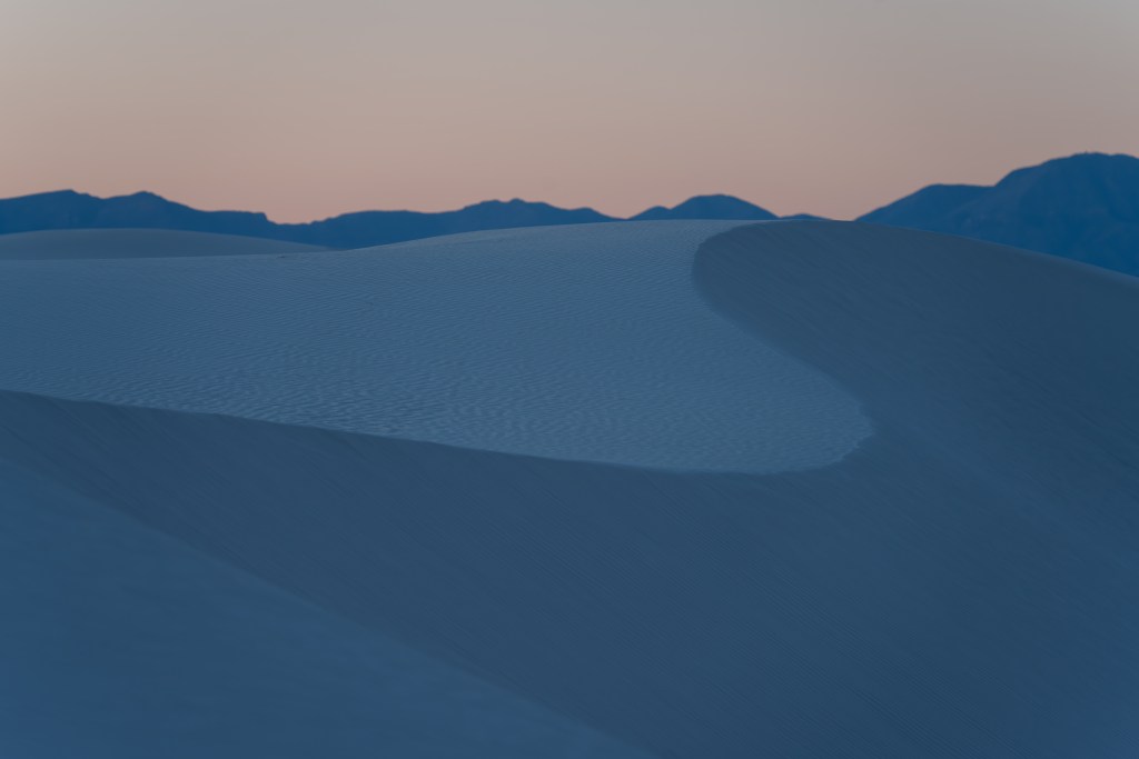
The “trail” itself is more of a game of connect-the-dots than it was a trail. Orange fiberglass markers were either buried to the last 2 inches, or stuck out at the peak of a dune 3ft high. Once we would reach a marker, we often would stand and reorient ourselves to the next marker for a minute or two. It only took a handful of dunes to cross before we realized how deep into the dune-field we were. The only real landmarks were the San Andres Mountains to our west, the Sacramento Mountains to our east, and a slightly ominous military base to our north.
The desolation became more and more apparent the more dunes we crossed. Slowly, we left the visitors sledding behind, left with only the occasional photographer seeking undisturbed dunes or barefoot hiker seeking solitary moments I guess. Eventually Erica and I were alone. Looking around at the peak of a dune, I ask Erica what she would do if she found herself out here alone. She answered she’d go to the military base and get arrested, before just admitting to being very lost. I agreed.
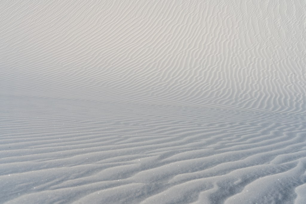
Around this time, I began to realize how otherworldly these dunes really felt. The pristine white of the dunes, the glitter as the gypsum sand grains capture the light, and the complete lack of life made me feel less and less that I was on the same Earth as I was earlier in the day. The sun beating down on us brought very little warmth, as the wind would chill our bones just as quick. The only sign of life were the waning desert shrubs clinging to the moist alkali flats for nutrition.
We descend from the final dune – and I mean this, it was the last dune. After this dune was flat desert lands all the way to the base of the mountains. The trail culminated in a warning sign, telling us to turn back and follow the trail, as beyond the sign were unexploded military ordinance. I guess if we were lost, we wouldn’t go to the base.
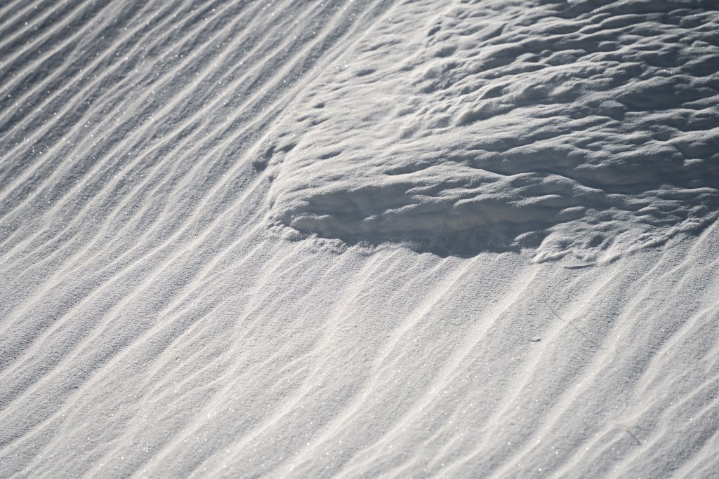
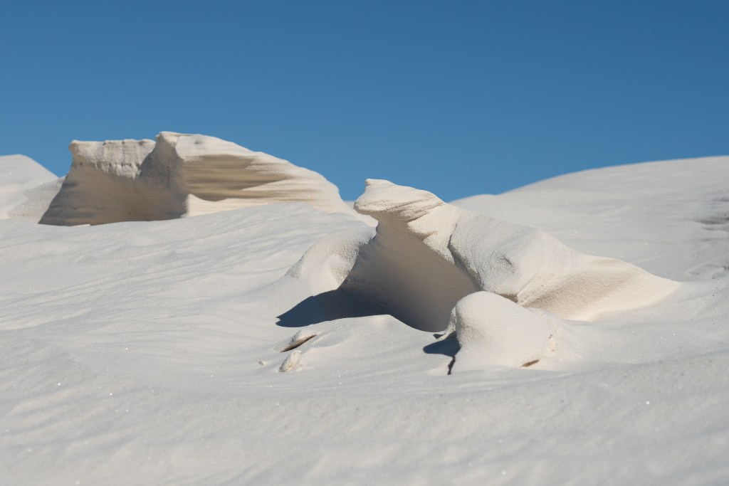
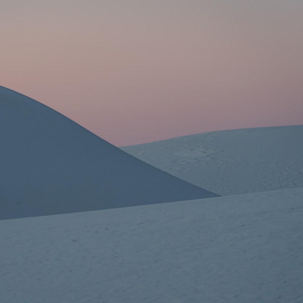
The second half of the trail brought with it more vistas and objects of interest than the first half. Occasionally, the wind would carve the sand around some hardened gypsum, lifting an apparent boulder out of the dune.
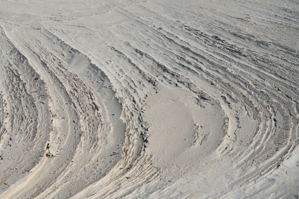
Or, a playa would support wind torn sand, molded by the water table. I decided the area would be my choice for sunset photos later in the day.
Back at the car, we break for more water and snacks. After a short rest, we stand back up and our bodies scream. The climbs apparently had taken a physical toll on us, despite none of it ever feeling that difficult. It really was a sneaky hike.
I tug Erica back out (good grief the atrocities I committed against a 7 months pregnant woman), focusing on playas to travel through versus climbing more dunes. I pull out a camp chair for her to rest on at the peak of her last dune to climb, and set up for photos.
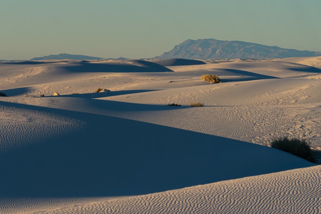
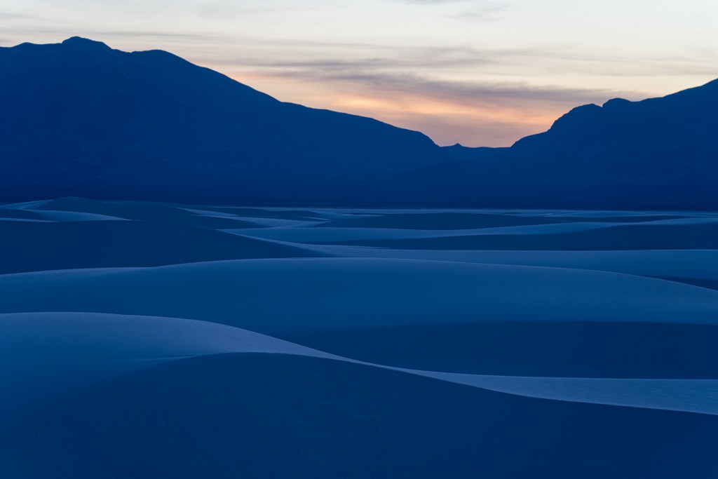
Slowly as the sun set behind the San Andres, the dunes mirrored the sky and transformed before our eyes. From pristine whites to mellow gold, the dunes transformed to blazing orange, before muting to smokey greys and blues, and finally deepening into indigo and navy hues. I focused on lines and textures to capture the juxtaposition of thousands of years of work to create the dunes and the minute by minute transformations the wind and sun paint on this land.
Just as the final light is passing by, I receive a dreaded message on my camera – battery exhausted. What a rookie mistake! It was time to head out either way, so we packed up, switched on our headlamps, and trudged our way through the playas.
Both of us aching, Erica asks how much longer. I suspected just the last corner, and I was right! Headlights in the parking lot! Accompanied with… red and blue flashes?
Erica and I discussed hope that whoever was in trouble was okay. Rounding the final corner to the parking lot we realize we were the last car. We were the ones in trouble. The last 20 yards of walking included some impromptu planning, aligning our stories and excuses. Notably, Erica’s progression into growing a small child.
The ranger was polite, and immediately respected the extra time we took for Erica’s condition. A verbal warning later, and we were quickly (but not very accurately…) leaving the park.
A quick confrontation with Federal Law Enforcement got us pretty hungry, and we had a wonderful dinner at D. H. Lescombs before heading on a grueling drive to Hobbes, NM. The next morning, the Calvary was headed to Nonnie and Pop.
See ya next time, with the whole fam.

Leave a comment